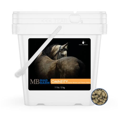
Analyze Diet
Animals : an open access journal from MDPI2025; 15(24); 3507; doi: 10.3390/ani15243507

Using Satellite Remote Sensing to Estimate Rangeland Carrying Capacity for Sustainable Management of the Marismeño Horse in Doñana National Park, Spain.

Abstract: Rangeland degradation poses a serious challenge for the sustainable management of free-ranging livestock in Mediterranean wetlands. In National Park, Spain, the endangered horse depends exclusively on natural forage, making it essential to monitor vegetation productivity and grazing suitability under increasing climate variability. This study presents a satellite-based assessment of rangeland carrying capacity to support the adaptive management of this iconic breed. A six-year time series (2015-2020) of 1242 images from Landsat 8 OLI/TIRS and Sentinel-2 (L1C/L2A) was processed using ILWIS and Python-based workflows to derive vegetation indices (GNDVI, NDMI) and model aboveground biomass, forage energy, and grazing pressure across five grazing units. Results revealed strong seasonal cycles, with biomass and nutritive value peaking in spring and declining sharply in summer. Ecotonal zones such as acted as crucial refuges during drought-induced resource shortages. The harmonized multi-sensor approach demonstrated high reliability for mapping forage dynamics and assessing carrying capacity at fine scales. This remote sensing framework offers an effective, scalable tool for sustainable livestock management in , directly supporting biodiversity conservation and the long-term resilience of Mediterranean rangeland ecosystems.
Publication Date: 2025-12-05 PubMed ID: 41463791PubMed Central: PMC12729776DOI: 10.3390/ani15243507Google Scholar: Lookup
The Equine Research Bank provides access to a large database of publicly available scientific literature. Inclusion in the Research Bank does not imply endorsement of study methods or findings by Mad Barn.
  • Journal Article

Summary

This research summary has been generated with artificial intelligence and may contain errors and omissions. Refer to the original study to confirm details provided. Submit correction.

Overview

  • This study uses satellite remote sensing to estimate the rangeland carrying capacity in Doñana National Park, Spain, focusing on the sustainable management of the endangered Marismeño horse that relies solely on natural forage.
  • The research integrates multi-year satellite data to monitor vegetation productivity and grazing suitability, aiding adaptive management strategies amid climate variability.

Introduction and Problem Statement

  • Rangeland degradation is a critical issue threatening the sustainable use of free-ranging livestock in Mediterranean wetland ecosystems.
  • The Marismeño horse, an endangered breed in Doñana National Park, depends exclusively on naturally available forage, making monitoring of vegetation productivity vital.
  • Climate variability exacerbates the risk of resource shortages, necessitating tools to track changes in vegetation and carrying capacity over time.

Methodology

  • The study utilized a six-year dataset (2015–2020) consisting of 1242 satellite images from two sources:
    • Landsat 8 OLI/TIRS
    • Sentinel-2 (L1C/L2A)
  • Data processing was conducted using ILWIS (Integrated Land and Water Information System) and Python-based workflows for efficient analysis.
  • Vegetation indices such as Green Normalized Difference Vegetation Index (GNDVI) and Normalized Difference Moisture Index (NDMI) were derived to assess vegetation health and moisture content.
  • Models were developed to estimate aboveground biomass, forage energy content, and grazing pressure across five designated grazing units within the park.

Key Findings

  • Strong seasonal cycles in biomass and nutritive value were observed, with:
    • Peak biomass and forage quality occurring during spring.
    • Marked declines in these metrics throughout the summer season.
  • Ecotonal zones (transition areas between ecosystems) served as critical refuges, providing food resources during droughts when other areas experienced scarcity.
  • The combined use of multiple satellite sensors enhanced the reliability and resolution of forage dynamics mapping, allowing fine-scale assessment of carrying capacity.

Implications and Significance

  • The satellite-based framework offers a scalable and effective tool for ongoing monitoring of natural forage conditions.
  • It supports adaptive management of the Marismeño horse population by informing decisions based on precise, timely vegetation and grazing data.
  • By ensuring sustainable grazing, the approach contributes to biodiversity conservation and enhances the resilience of Mediterranean rangeland ecosystems to climate variability.
  • This method can potentially be applied to other free-ranging livestock management systems in similar ecological contexts.

Conclusion

  • This research successfully demonstrated the value of utilizing remote sensing technology to inform sustainable rangeland management in a complex wetland ecosystem.
  • The study’s multi-sensor, multi-year approach provides critical insights into vegetation dynamics and carrying capacity that underpin the long-term viability of both the Marismeño horse and the surrounding landscape.

Cite This Article

APA
Ramírez-Juidias E, Díaz de la Serna-Moreno Á, Delgado-Pertíñez M. (2025). Using Satellite Remote Sensing to Estimate Rangeland Carrying Capacity for Sustainable Management of the Marismeño Horse in Doñana National Park, Spain. Animals (Basel), 15(24), 3507. https://doi.org/10.3390/ani15243507

Publication

ISSN: 2076-2615
NlmUniqueID: 101635614
Country: Switzerland
Language: English
Volume: 15
Issue: 24
PII: 3507

Researcher Affiliations

Ramírez-Juidias, Emilio
  • Instituto Universitario de Arquitectura y Ciencias de la Construcción (IUACC), Universidad de Sevilla, 2 Reina Mercedes Avenue, 41012 Seville, Spain.
Díaz de la Serna-Moreno, Ángel
  • Departamento de Agronomía, Escuela Técnica Superior de Ingeniería Agronómica, Universidad de Sevilla, Ctra. Utrera Km 1, 41013 Sevilla, Spain.
Delgado-Pertíñez, Manuel
  • Departamento de Agronomía, Escuela Técnica Superior de Ingeniería Agronómica, Universidad de Sevilla, Ctra. Utrera Km 1, 41013 Sevilla, Spain.

Conflict of Interest Statement

The authors declare no conflicts of interest.

References

This article includes 44 references
  1. Fernández-Delgado C. Conservation management of an European Natural Area: Doñana National Park, Spain. In: Groom M.J., Meffe G.K., Carroll C.R., editors. Principles of Conservation Biology. 3rd ed. Sinauer Associates, Inc. Publishers; Sunderland, MA, USA: 2006. pp. 536–543.
  2. Martín-López B., García-Llorente M., Palomo I., Montes C. The conservation against development paradigm in protected areas: Valuation of ecosystem services in the Doñana social-ecological system (Southwestern Spain) Ecol. Econ. 2011;70:1481–1491. doi: 10.1016/j.ecolecon.2011.03.009.
  3. Murphy M.D., González Faraco J.C. Las yeguas marismeñas de Doñana: Naturaleza, tradición e identidades sociales en un espacio protegido. Disparidades. 2002;57:5–40. doi: 10.3989/rdtp.2002.v57.i2.172.
  4. MAPA, Ministerio de Agricultura, Pesca y Alimentación. Raza Marismeña. 2025. [(accessed on 5 July 2025)]. Available online: https://www.mapa.gob.es/es/ganaderia/temas/zootecnia/razas-ganaderas/razas/catalogo-razas/equino-caballar/marismena. (In Spanish)
  5. Ministry of Agriculture, Fisheries and Food . Real Decreto 527/2023. De 20 de Junio, por el que se Modifican el Anexo I del Real Decreto 45/2019, de 8 de Febrero, para Actualizar el Catálogo Oficial de Razas de Ganado de España, y el Anexo II, de Codificación de Razas, del Real Decreto 429/2022, de 7 de Junio. Boletín Oficial Del Estado, 147, 87369–87375. Ministry of Agriculture, Fisheries and Food; Madrid, Spain: 2023.
  6. Pablo Gómez M., Landi V., Martínez A.M., Gómez Carpio M., Nogales Baena S., Delgado Bermejo J.V., Oom M.d.M., Luis C., Ouragh L., Vega-Pla J.L. Genetic diversity of the semi-feral Marismeño horse breed assessed with microsatellites. Ital. J. Anim. Sci. 2017;16:14–21. doi: 10.1080/1828051X.2016.1241132.
  7. Teague R., Kreuter U. Managing grazing to restore soil health, ecosystem function, and ecosystem services. Front. Sustain. Food Syst. 2020;4:534187. doi: 10.3389/fsufs.2020.534187.
    doi: 10.3389/fsufs.2020.534187google scholar: lookup
  8. Cavadini J., Paine L. Grazier’s Math: Calculating Carrying Capacity 2024. [(accessed on 10 September 2025)]. Available online: https://cropsandsoils.extension.wisc.edu/files/2024/03/025-2024-FS-Carrying-Capacity-2.pdf.
  9. Vanselow K.A., Zandler H., Samimi C. Methods of Assessing Vegetation Dynamics and Pasture Potentials in Arid Mountain Regions. In: Mueller L., Sychev V.G., Dronin N.M., Eulenstein F., editors. Exploring and Optimizing Agricultural Landscapes. Springer International Publishing; Cham, Switzerland: 2021. pp. 373–382. Innovations in Landscape Research.
  10. Zandler H., Vanselow K.A., Faryabi S.P., Rajabi A.M., Ostrowski S. High-resolution assessment of the carrying capacity and utilization intensity in mountain rangelands with remote sensing and field data. Heliyon. 2023;9:e21583. doi: 10.1016/j.heliyon.2023.e21583.
  11. Jansen V., Kolden C., Schmalz H., Karl J., Taylor R. Using Satellite-Based Vegetation Data for Short-Term Grazing Monitoring to Inform Adaptive Management. Rangel. Ecol. Manag. 2021;76:30–42. doi: 10.1016/j.rama.2021.01.006.
  12. Jansen V., Traynor A.C.E., Karl J.W., Lepak N., Sprinkle J. Monitoring grazing use: Strategies for leveraging technology and adapting to variability. Rangelands. 2022;44:64–77. doi: 10.1016/j.rala.2021.07.005.
  13. Lumbierres M., Méndez P.F., Bustamante J., Soriguer R., Santamaría L. Modeling Biomass Production in Seasonal Wetlands Using MODIS NDVI Land Surface Phenology. Remote Sens. 2017;9:392. doi: 10.3390/rs9040392.
    doi: 10.3390/rs9040392google scholar: lookup
  14. Giralt-Rueda J.M., Santamaria L. Complementary Differences in Primary Production and Phenology among Vegetation Types Increase Ecosystem Resilience to Climate Change and Grazing Pressure in an Iconic Mediterranean Ecosystem. Remote Sens. 2021;13:3920. doi: 10.3390/rs13193920.
    doi: 10.3390/rs13193920google scholar: lookup
  15. Almalki R., Khaki M., Saco P.M., Rodriguez J.F. Monitoring and Mapping Vegetation Cover Changes in Arid and Semi-Arid Areas Using Remote Sensing Technology: A Review. Remote Sens. 2022;14:5143. doi: 10.3390/rs14205143.
    doi: 10.3390/rs14205143google scholar: lookup
  16. Wang H., Singh K.D., Poudel H.P., Natarajan M., Ravichandran P., Eisenreich B. Forage Height and Above-Ground Biomass Estimation by Comparing UAV-Based Multispectral and RGB Imagery. Sensors. 2024;24:5794. doi: 10.3390/s24175794.
    doi: 10.3390/s24175794pmc: PMC11397825pubmed: 39275705google scholar: lookup
  17. Zhang R.P., Zhou J.H., Guo J., Miao Y.H., Zhang L.L. Inversion Models of Aboveground Grassland Biomass in Xinjiang Based on Multisource Data. Front. Plant Sci. 2023;14:1152432. doi: 10.3389/fpls.2023.1152432.
    doi: 10.3389/fpls.2023.1152432pmc: PMC10040755pubmed: 36993850google scholar: lookup
  18. Kearney S.P., Porensky L.M., Augustine D.J., Gaffney R., Derner J.D. Monitoring Standing Herbaceous Biomass and Thresholds in Semiarid Rangelands from Harmonized Landsat 8 and Sentinel-2 Imagery to Support Within-Season Adaptive Management. Remote Sens. Environ. 2022;271:112907. doi: 10.1016/j.rse.2022.112907.
    doi: 10.1016/j.rse.2022.112907google scholar: lookup
  19. Law B.E., Abatzoglou J.T., Schwalm C.R., Byrne D., Fann N., Nassikas N.J. Anthropogenic Climate Change Contributes to Wildfire Particulate Matter and Related Mortality in the United States. Commun. Earth Environ. 2025;6:336. doi: 10.1038/s43247-025-02314-0.
    doi: 10.1038/s43247-025-02314-0pmc: PMC12048342pubmed: 40321670google scholar: lookup
  20. Zoffoli M.L., Gernez P., Oiry S., Godet L., Dalloyau S., Rowe Davies B.F., Barillé L. Remote Sensing in Seagrass Ecology: Coupled Dynamics between Migratory Herbivorous Birds and Intertidal Meadows Observed by Satellite during Four Decades. Remote Sens. Ecol. Conserv. 2022;9:420–433. doi: 10.1002/rse2.319.
    doi: 10.1002/rse2.319google scholar: lookup
  21. Irob K., Blaum N., Weiss-Aparicio A., Hauptfleisch M., Hering R., Uiseb K., Tietjen B. Savanna Resilience to Droughts Increases with the Proportion of Browsing Wild Herbivores and Plant Functional Diversity. J. Appl. Ecol. 2023;60:251–262. doi: 10.1111/1365-2664.14351.
    doi: 10.1111/1365-2664.14351google scholar: lookup
  22. Zhang Z., Zhu L. A Review on Unmanned Aerial Vehicle Remote Sensing: Platforms, Sensors, Data Processing Methods, and Applications. Drones. 2023;7:398. doi: 10.3390/drones7060398.
    doi: 10.3390/drones7060398google scholar: lookup
  23. Cao Q., Yu G., Qiao Z. Application and Recent Progress of Inland Water Monitoring Using Remote Sensing Techniques. Environ. Monit. Assess. 2023;195:125. doi: 10.1007/s10661-022-10690-9.
    doi: 10.1007/s10661-022-10690-9pubmed: 36401670google scholar: lookup
  24. Zhang X., Zhou Y., Luo J. Deep Learning for Processing and Analysis of Remote Sensing Big Data: A Technical Review. Big Earth Data. 2021;6:527–560. doi: 10.1080/20964471.2021.1964879.
  25. Reinermann S., Boos C., Kaim A., Schucknecht A., Asam S., Gessner U., Annuth S.H., Schmitt T.M., Koellner T., Kiese R. Grassland Yield Estimations—Potentials and Limitations of Remote Sensing in Comparison to Process-Based Modeling and Field Measurements. Biogeosciences. 2025;22:4969–4992. doi: 10.5194/bg-22-4969-2025.
    doi: 10.5194/bg-22-4969-2025google scholar: lookup
  26. Straffelini E. Ph.D. Thesis. Università Degli Studi di Padova; Padova, Italy: 2025. [(accessed on 2 December 2025)]. Cultural Landscapes Under Global Environmental Change: Monitoring and Assessment Through Remote Sensing and GIS. Available online: https://hdl.handle.net/20.500.14242/190501.
  27. Reeves M.C., Robert A., Angerer J., Hunt E.R., Jr., Wasantha R., Kumar L. Remote Sensing Handbook. CRC Press Inc.; Boca Raton, FL, USA: 2024. A Global view of remote sensing of rangelands: Evolution, applications, future pathways; pp. 237–266.
  28. Hu X., Feng H., Tang Y., Wang S., Wang S., Wang W., Huang J. Detection of the Contribution of Vegetation Change to Global Net Primary Productivity: A Satellite Perspective. Remote Sens. 2024;16:4692. doi: 10.3390/rs16244692.
    doi: 10.3390/rs16244692google scholar: lookup
  29. Liu Q., Yao F., Garcia-Garcia A., Zhang J., Li J., Ma S., Peng J. The Response and Sensitivity of Global Vegetation to Water Stress: A Comparison of Different Satellite-Based NDVI Products. Int. J. Appl. Earth Obs. Geoinf. 2023;120:103341. doi: 10.1016/j.jag.2023.103341.
    doi: 10.1016/j.jag.2023.103341google scholar: lookup
  30. Upreti M., Kumar A. Evaluating Functional Traits of Urban Green Spaces in Mitigating Land Surface Temperature in Megacities. Discov. Cities. 2025;2:31. doi: 10.1007/s44327-025-00074-2.
  31. Cabello-Franco E.J., Antón D., Ramírez-Juidias E., Perea-Torres F. Optimizing Water Demand in Citrus Orchards: A Novel Model Using Evolutionary Algorithms on Sentinel-1 Time Series Data. Cogent Food Agric. 2025;11:2544960. doi: 10.1080/23311932.2025.2544960.
  32. Ramírez-Juidias E., Amaro-Mellado J.-L. Prediction of Erosive Processes in the Río Piedras and Flecha de El Rompido Salt Marsh (Huelva, Spain) Using Iterative Models and GIS. Limnol. Rev. 2023;23:190–202. doi: 10.3390/limnolrev23030012.
    doi: 10.3390/limnolrev23030012google scholar: lookup
  33. Ramírez-Juidias E., Antón D. Geospatial Analysis of the Roman Site of Munigua Based on RGB Airborne Imagery. Remote Sens. 2025;17:3224. doi: 10.3390/rs17183224.
    doi: 10.3390/rs17183224google scholar: lookup
  34. Leiva-Piedra J.L., Ramírez-Juidias E., Amaro-Mellado J.-L. Use of Geomatic Techniques to Determine the Influence of Climate Change on the Evolution of the Doñana Salt Marshes’ Flooded Area between 2009 and 2020. Appl. Sci. 2024;14:6919. doi: 10.3390/app14166919.
    doi: 10.3390/app14166919google scholar: lookup
  35. Confederación Hidrográfica del Guadalquivir. Ministerio para la Transmisión Ecológica y el Reto Demográfico (Gobierno de España) Informe de Estado de los Acuíferos del Entorno de Doñana. Año Hidrológico 2022–2023. Ministerio para la Transición Ecológica y el Reto Demográfico; Seville, Spain: 2024.
  36. Blanco-Doval A., Barron L.J.R., Aldai N. Nutritional Quality and Socio-Ecological Benefits of Mare Milk Produced under Grazing Management. Foods. 2024;13:1412. doi: 10.3390/foods13091412.
    doi: 10.3390/foods13091412pmc: PMC11083796pubmed: 38731783google scholar: lookup
  37. Curz-Moriana V. Ph.D. Thesis. Universidad de Sevilla; Seville, Spain: 2024. [(accessed on 2 December 2025)]. Evaluación y Valorización de la Multifuncionalidad en Sistemas Extensivos de Rumiantes de Aptitud Cárnica Basados en Razas Locales Amenazadas. idUS Repository. Available online: https://idus.us.es/server/api/core/bitstreams/1113f73e-2b66-4b46-9dc4-92843042030a/content.
  38. Acreman M., Casier R., Salathe T. Evidence-Based Risk Assessment of Ecological Damage Due to Groundwater Abstraction: The Case of Doñana Natural Space, Spain. Wetlands. 2022;42:63. doi: 10.1007/s13157-022-01570-6.
  39. Junta de Andalucía . Análisis de la Evolución Futura Bajo Escenarios de Cambio Climático de las Variables Climáticas y de las Variables Derivadas. Junta de Andalucía; Seville, Spain: 2022.
  40. EOS Data Analytics LandViewer. [(accessed on 14 August 2025)]. Available online: https://eos.com/landviewer/
  41. Spanish Association of Marismeño Horse Breeders. [(accessed on 17 August 2025)]. Available online: https://razamarismena.com/
  42. Climate Data. Climate Data for Cities Worldwide. 2024. [(accessed on 15 August 2025)]. Available online: https://en.climate-data.org/
  43. United Nations Transforming Our World: The 2030 Agenda for Sustainable Development. [(accessed on 10 August 2025)]. Available online: https://sdgs.un.org/2030agenda.
  44. Gomes A.M.N., Sousa A.M.d., Carvalho M.W.L., Sousa W.d.S., Silva M.V.d., de Araújo Santos G.A., Medeiros A.d.S., Silva J.L.B.d., Oliveira-Júnior J.F.d., Machado N.A.F. Assessment of Land Degradation in the State of Maranhão to Support Sustainable Development Goal 15.3.1 in the Agricultural Frontier of MATOPIBA, Brazil. ISPRS Int. J. Geo-Inf. 2025;14:356. doi: 10.3390/ijgi14090356.
    doi: 10.3390/ijgi14090356google scholar: lookup

Citations

This article has been cited 0 times.